Using StreetView to investigate coral diversity
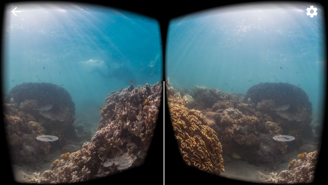
Street View enables you to explore places with the full 360 degrees. Click Explore, Choose a location, and click the Google Cardboard icon. You do really feel like you are part of the place. This could be valuable in helping students develop an appreciate of the places you are studying, and to get a better understanding of what those places are actually like.
|
Search for a location.
The location of the various options will show on the map. Select one of the options by scrolling down and clicking on your choice. Students can maneuver around the reef. By scrolling to the right or left for a 360o view or by moving the forward or back arrows. If students have access to a virtual reality head set they can click the headset icon to view it in a more immersive way. |
Virtual reality lesson - StreetView
Use Google Streetview to examine a range of sites around the Great Barrier Reef and Coral Triangle. Choose specific sites, eg, several locations around Lizard Island, or Kimbe Bay. Compare the two main virtual field sites.
Make judgements about the quality of the corals, the colours of the corals, etc.
Try to identify specific types of coral. You will need to refer to a coral identification site.
Compare the complexity and biodiversity or the two sites.
Find two secondary sources that support your findings.